I’ve experienced several opportunities to explore all around Portland on the Oregon side of the river, but until today I hadn’t spent any time on the Washington side of the Columbia River, or in other areas of Southwestern Washington, so it was time to expand my wandering.
The day started out around 0730 as I headed through downtown Portland and then west on Hwy 30. My first destination of the day was breakfast in St Johns, but I knew the cafe I was headed for wasn’t open until 0900, so I went on a little side quest first, crossing and then photographing the St Johns Bridge.
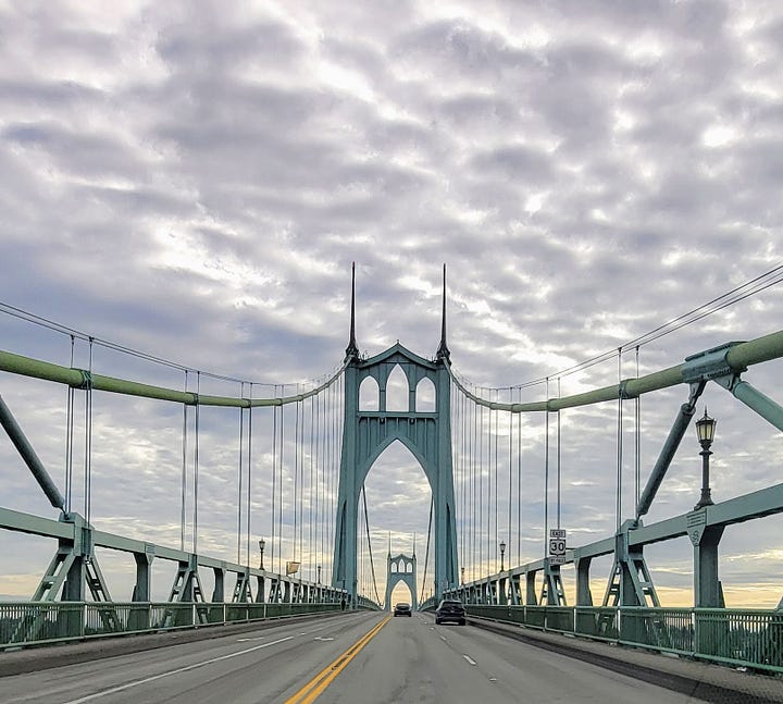
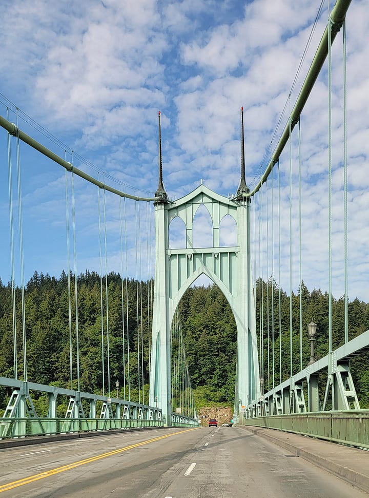
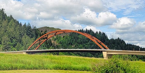
The St. Johns bridge is the northern/western-most of the twelve bridges that cross the Willamette River in Portland. It has many other superlatives as well; namely, it is the most beautiful among them, or really any bridge in America in my opinion and other’s.
After only two years of labor, when it was completed in 1931, the bridge was the longest suspension bridge east of Detroit, it was also the tallest suspension bridge in the nation with 205 feet of clearance from the bridge deck to the water (The Golden Gate Bridge wasn’t completed until 1937, surpassing the record by 15 feet with 220 feet of clearance). So, for those with acrophobia it can be quite the experience.
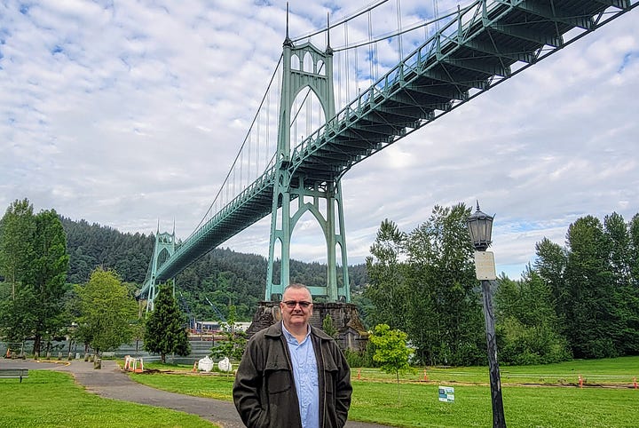
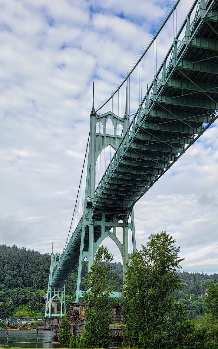
After crossing the bridge, I made my way down to Cathedral Park to see the bridge’s underbelly. It’s massive span and 400+ foot tall arching gothic-style towers are just as impressive up close, as the deck and towers are from above.
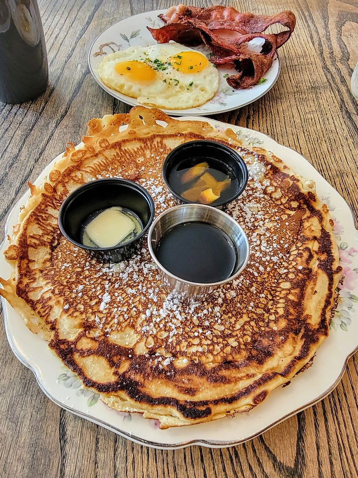
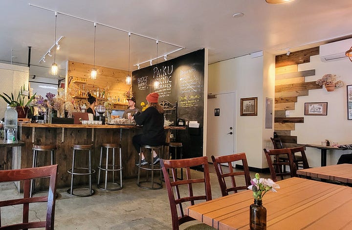
Having very productively spent my time, and with the clock nearing 0900, I made my way a couple blocks over to Paiku, a little cafe putting out big flavors. As the second one in the door, I was quickly seated and directed to the counter for self-serve coffee after I ordered up the Classic Breakfast. The combo consisted of a large pancake with 3 strips of bacon and two beautifully sunny side up eggs. The pancake also came with real butter and maple syrup and a wonderful liquidy lemon marmalade. I’m not a marmalade kind of guy but mixing that and the syrup on the pancake provided the exact amount of sweet and tart that it needed. They also provided me a bottle of their house made hot sauce, which I drizzled over the eggs. It tasted similar to a Tabasco, but less watery. Overall, a friendly experience that I’d recommend to anyone looking for delicious food at a reasonable price ($17 for the combo).
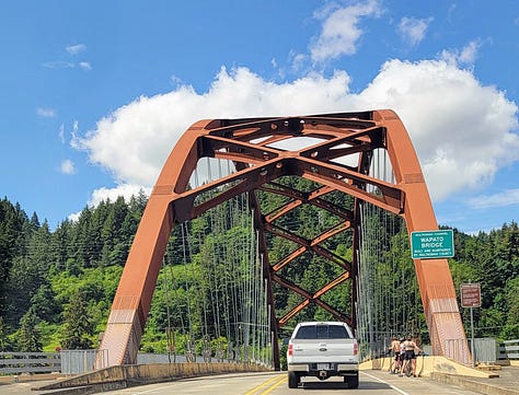
With my first mission of the day complete (full belly), it was time to head out to my second destination, Sauvie Island. The island was a mere 10-minutes and yet years away from downtown Portland. To reach the island one has to cross the only gateway, the Waputo Bridge, named after one of the local indigenous tribes.
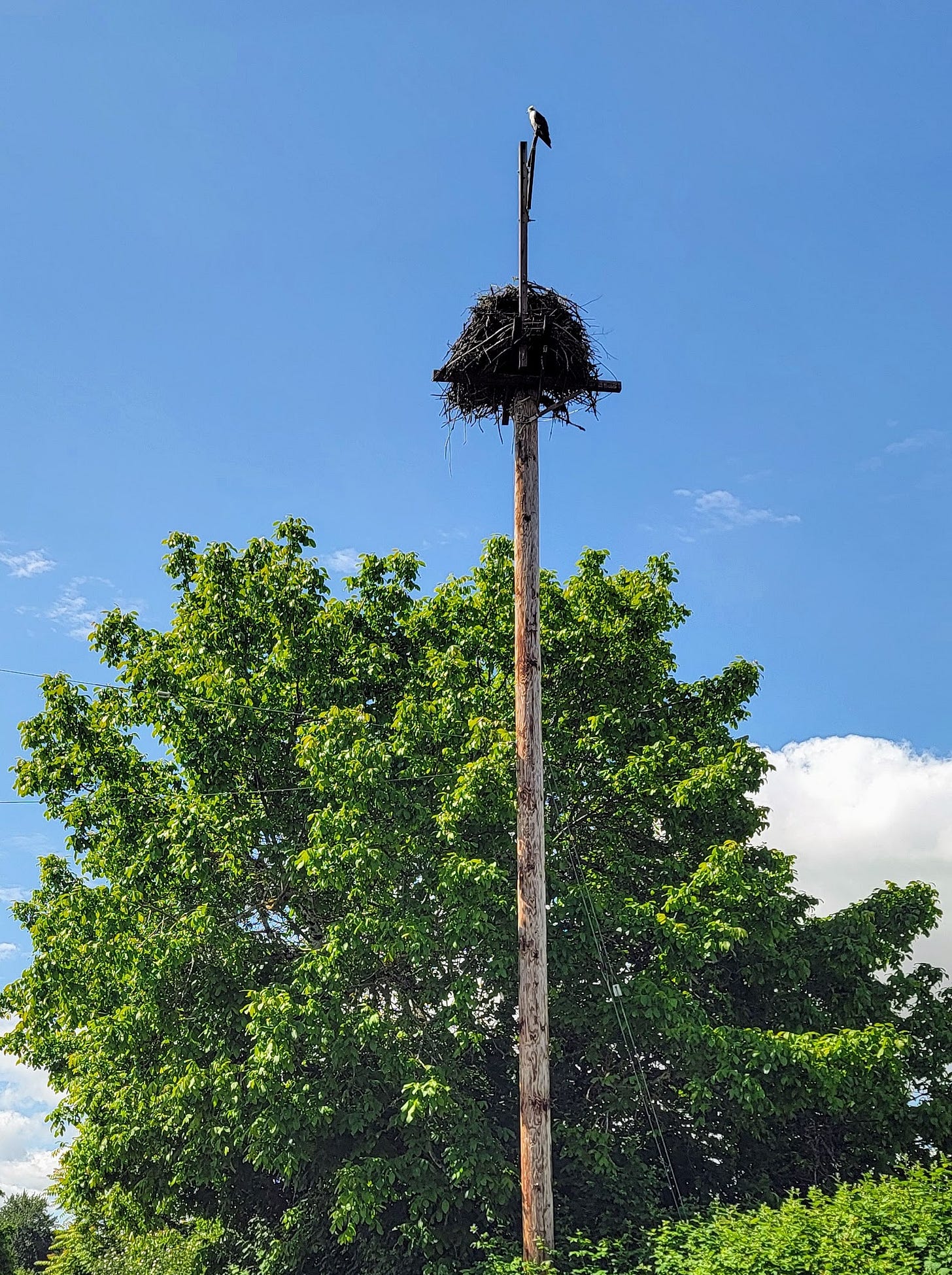
Once on the 24,000-acre island it’s a pretty simple affair to take the roads that ring the island, traveling by U-Pick fruit and vegetable farms, dairy farms, plant and flower nurseries and several boat harbors. Birds are everywhere and one in particular, the Osprey, makes its home known on several telephone poles scattered throughout the island in massive nests.
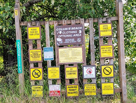
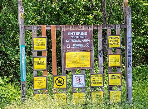
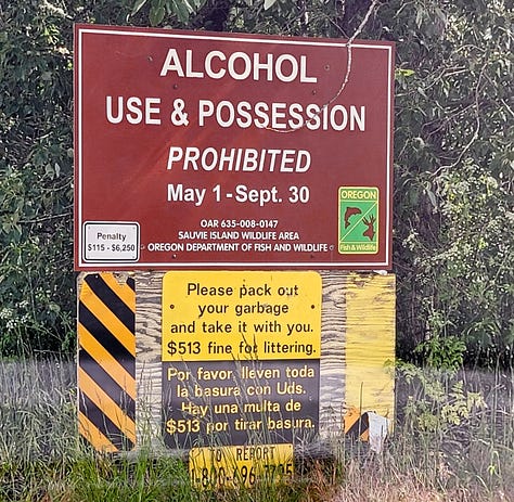
Portland’s oddities also extend to Sauvie island and are readily visible. As soon as one crosses the Waputo bridge (and scattered again throughout the island) there is a sign reminding everyone that alcohol is prohibited on the island May to Sept due to summertime alcohol-related problems. Seems people can’t control themselves here either. This is followed about 15 minutes up the road with signs for multiple nude clothing optional beaches.
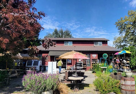
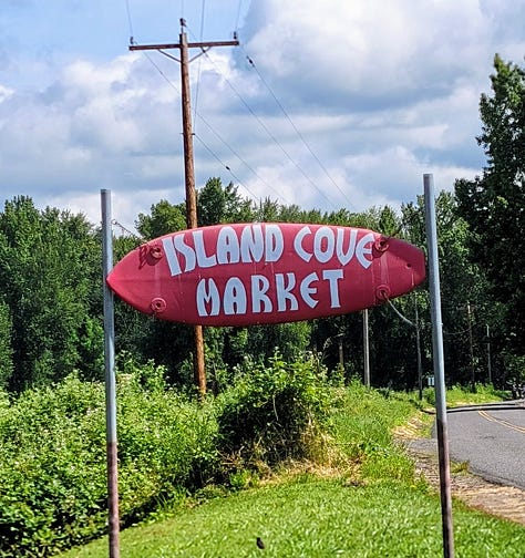
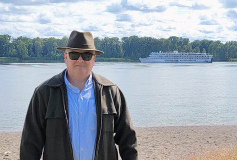
I made a loop of the island, checking out the lay of the land, but given the timing most of the fruit on the island wouldn’t be ready for picking for another month or so and most everything was closed. There is a small market right at the entrance to the left of the bridge, and another further up the island, along with some private hunting clubs, but no other retail or shopping is on the island. I stopped at one of the regular beaches (Yes, I wore my clothes) on this 60-degree Sunday morning, just as the American Cruise Lines Northwest Pioneer Cruise was heading downstream.
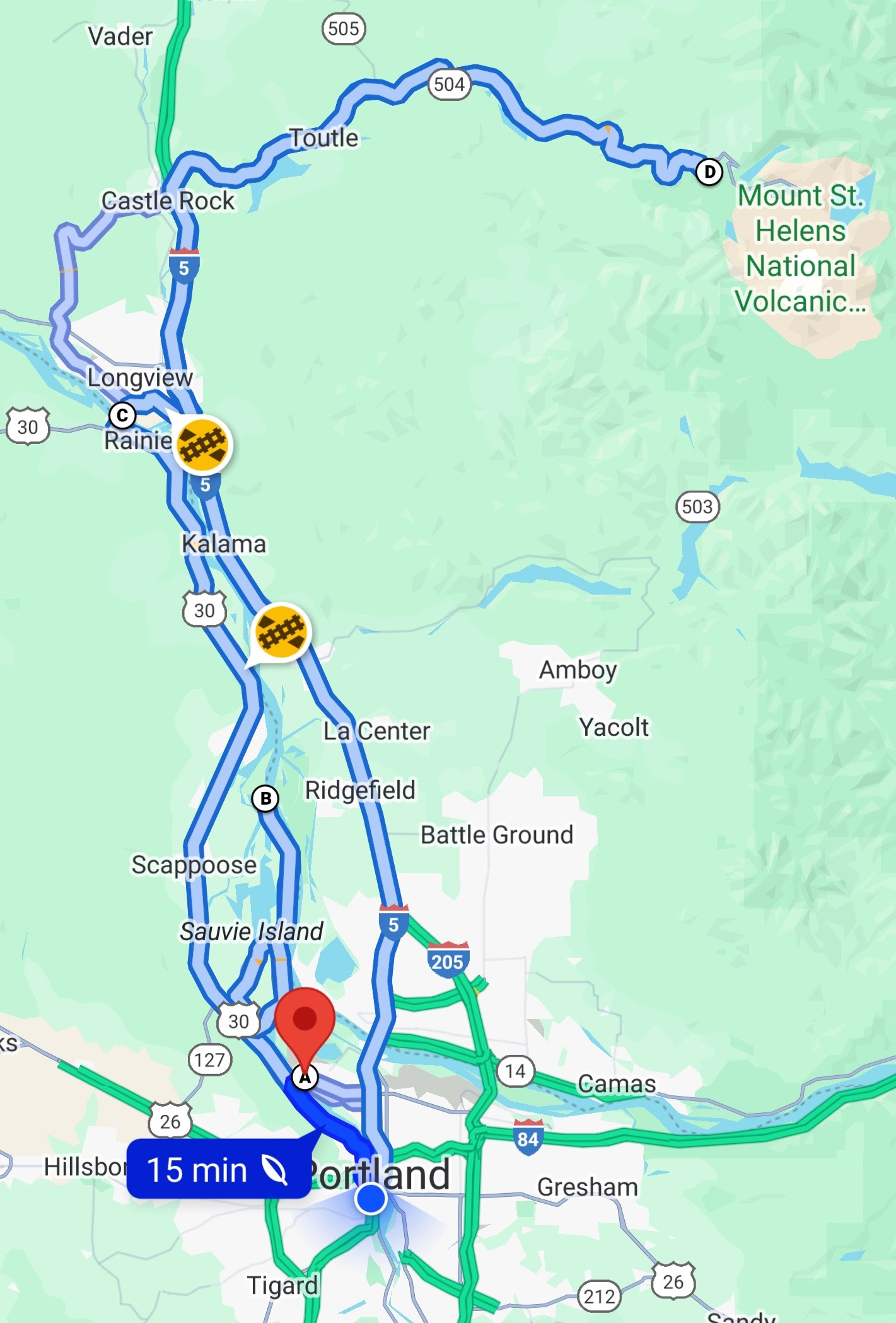
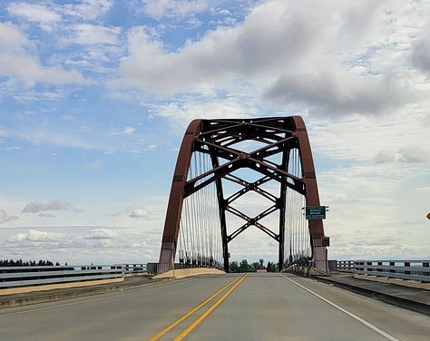
Phase two of the day’s activities complete, I left the island and continued northwest down Hwy 30 until I reached the Lewis and Clark Bridge crossing the Columbia River.
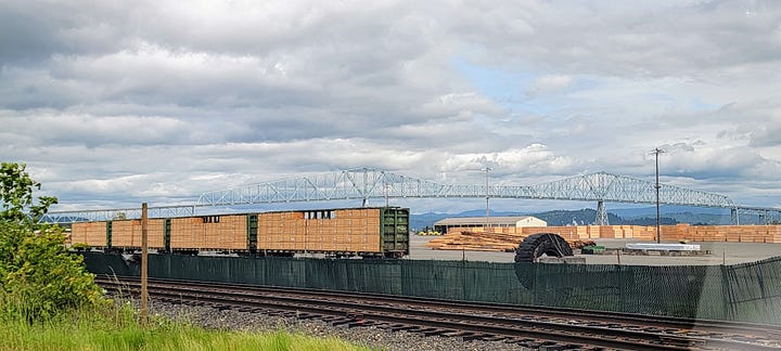
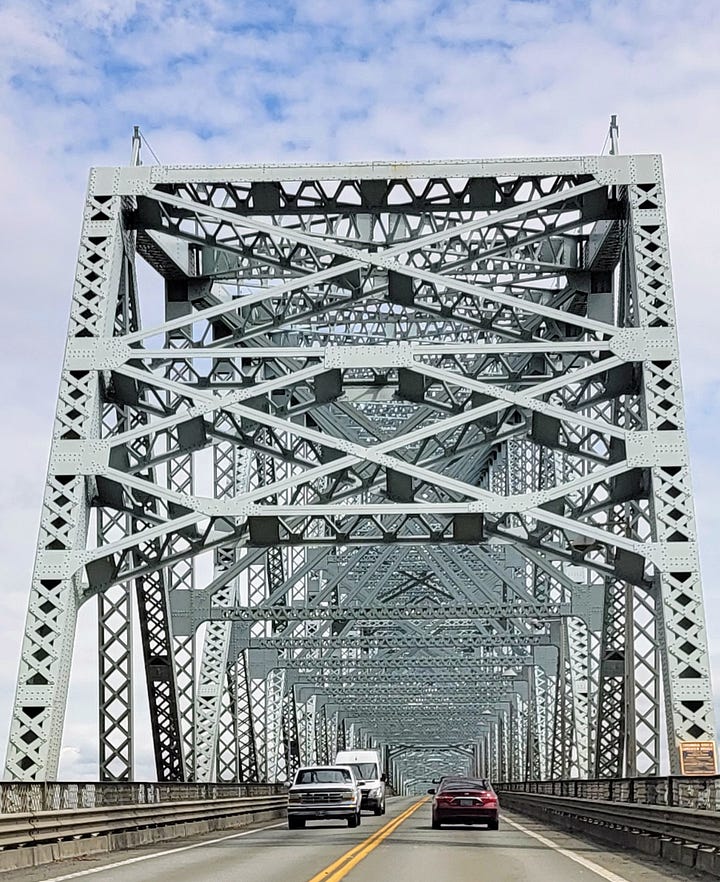
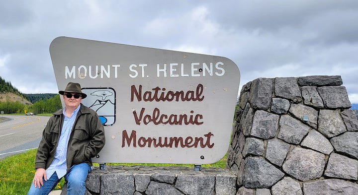
The Lewis and Clark Bridge is a cantilever bridge, and when built in 1930 was the longest of its type in America. It was designed by Joseph Strauss, who also designed the Golden Gate Bridge. So, I crossed the bridge and entered the state of Washington, turned right onto Hwy 432 for a couple miles then made my way north on Hwy 5 for about 23 miles, getting off the thoroughfare and onto the much smaller mostly two-laned Hwy 504, otherwise known as Spirit Lake Hwy.
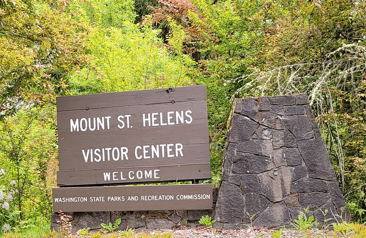
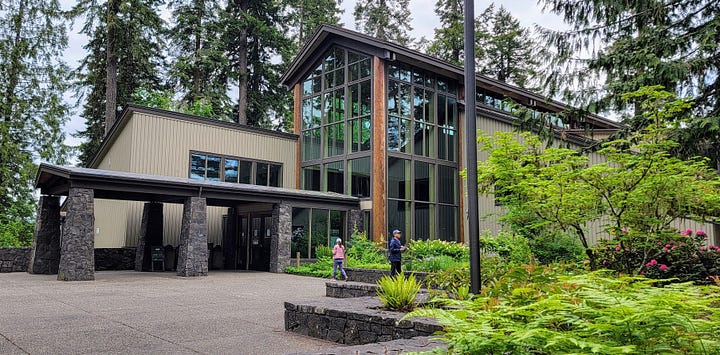
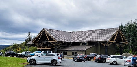
My first stop was at milepost 5, the Mount St. Helens Visitor Center on Silver Lake, Seaquest State Park. I popped in to talk to a ranger to understand how far up the road I would be able to travel. I was informed that I would make it all the way up to milepost 45, the Coldwater Lake Recreation Area where the winter gate was located, blocking access to milepost 52, Johnston Ridge Observatory, which was closed anyway due to a landslide until at least 2026.
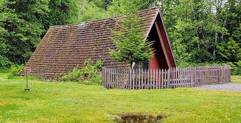
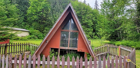
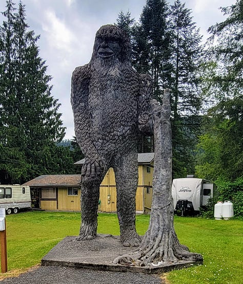
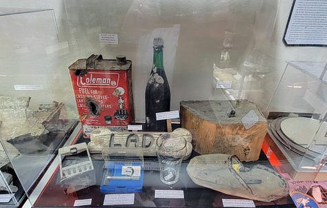
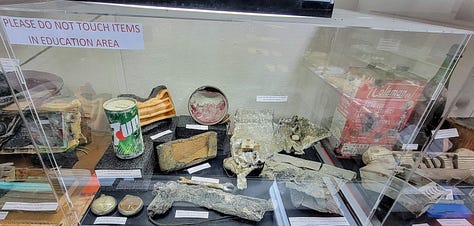
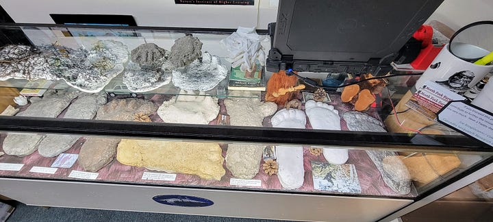
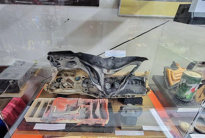
At milepost 19 I stopped in at the North Fork Survivor’s roadside attraction. Outside there is an A-Frame house that shows just how far and how deep the mud flow from the Mt St Helens volcanic eruption made it, along with cars from those that didn’t survive and a 28-ft tall Bigfoot.
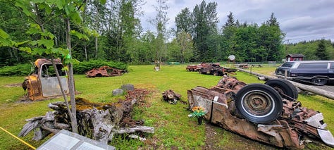
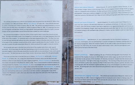
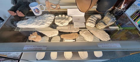
Inside the main store I met one of the proprietors who was wearing a hat similar to mine. I’m not sure if it was the hat or the fact that I was interested enough to step foot in his store, but as the local eruption historian he proceeded to spend the next 15 minutes telling me stories about the eruption, his connection to the victims, his efforts to curate artifacts and build a more permanent display than the cases he had in his store and more. I didn’t catch his name, but it was a fascinating discussion and if in the area I recommend stopping in to see the displays and hear the stories. While there were also casts of “Bigfoot” in the display cases, the discussion stayed firmly on the eruption and its aftereffects.
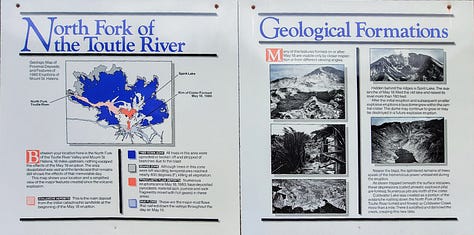
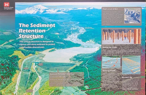
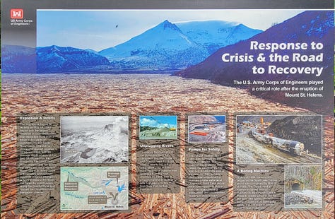
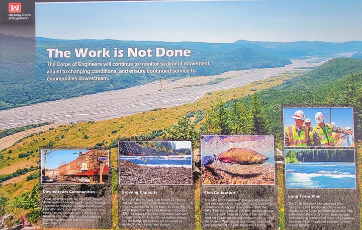
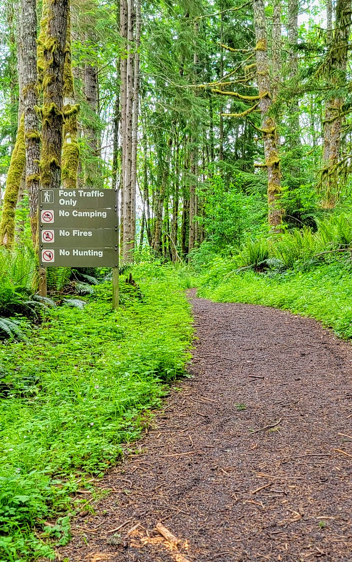
Shortly after leaving this attraction at milepost 22 I pulled into a parking lot and walked up a short but lusciously green trail to see the Toutle River Sediment Retention Structure. The importance of this structure being that even though there was enough mud from the original blast to build a highway 1-ft thick around the equator, there is still a lot of material upstream that needs to be stopped from inundating the downstream towns.
Next up was milepost 33, the Forest Learning Center. Inside they have some dioramas and a 6–8-minute video of 1980 news broadcasts showing the eruption. There is also a short trail and overlook where one can see the expansive mud field.
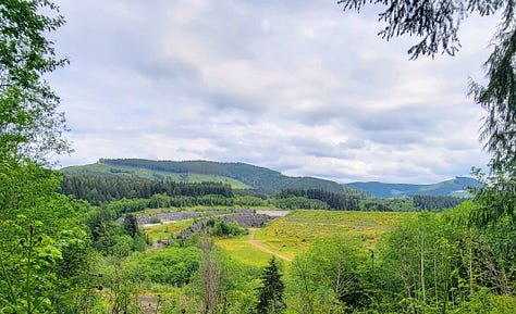
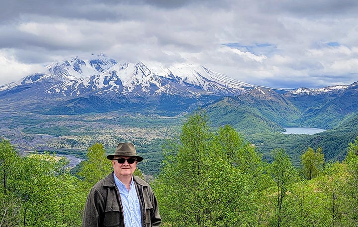
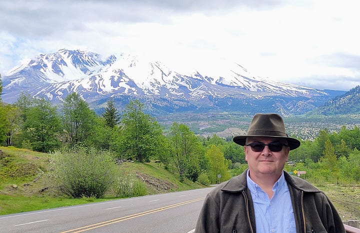
Given that it was an overcast day, this was the first point at which I could actually start to see the mountain itself in the background (Even on mostly clear days in Portland we don’t always have a clear view of the mountain from our livingroom as it is often encircled by its own micro weather patterns of clouds and fog).
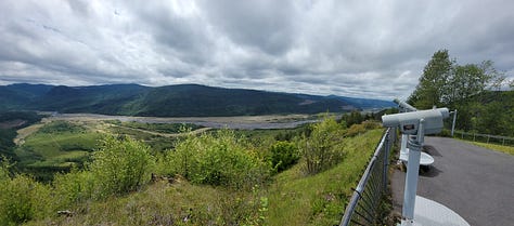
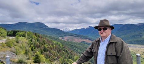
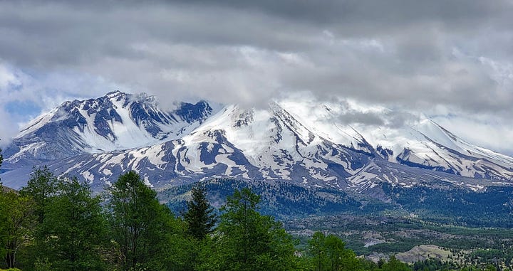
Heading up the road further to milepost 37, I stopped in at the Elk Rock viewpoint to snap a few more pictures and really begin to see the mountain up close. Even though I see the mountain from afar on most days, the mountain and the surrounding valleys are quite the thing to behold up close.
At milepost 45 I ran into the end of the line at this point in the season. The Coldwater Lake Recreation Area is as far as one can go for another month or so. Here, I got my final pics, turned around and headed back down the mountain.
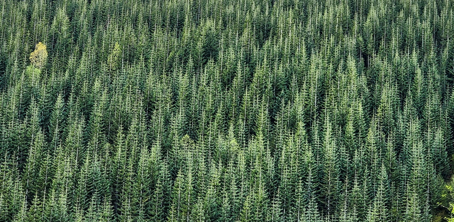
On the way up and back I kept seeing these areas of Lodge Pole Pines that had been planted back in the 1983-85 timeframe by Weyerhaeuser. Given that the trees in a contiguous area were all planted at the exact same time and would grow at the same rate their geometry would be the same with branches at the same heights, etc. creating this really interesting sort of dizzying fractals, not unlike what each tree experiences on a smaller scale individually. I had to stop and capture this as best as a picture can mimic real life.
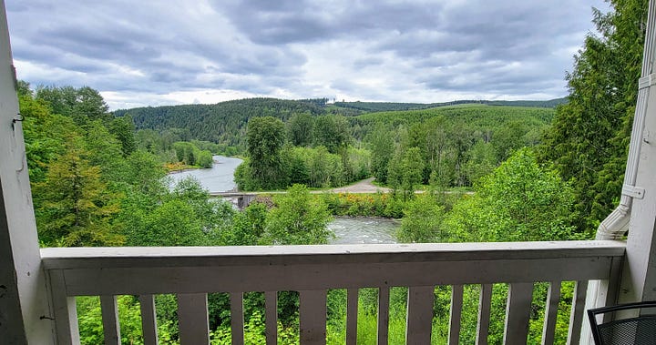
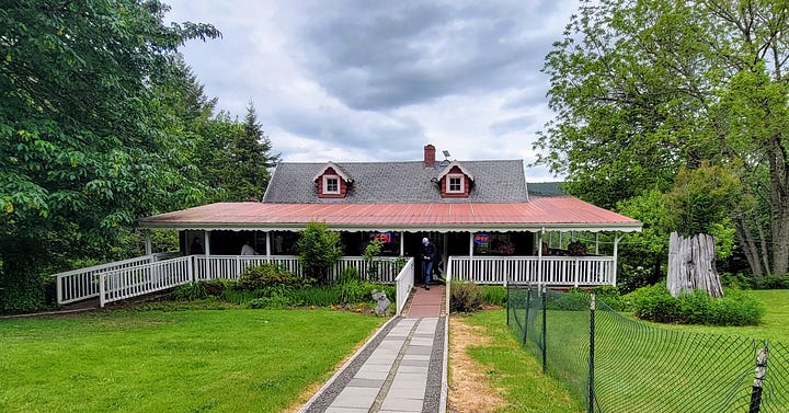
Half way back down the mountain I saw a lunch spot that I had glimpsed on the way up and decided to stop in for a visit. The Fire Mountain Grill is a great spot to get a bite to eat, play some horseshoes and watch the river. I highly recommend getting a seat outside on the back patio overlooking the North Fork of the Toutle River.
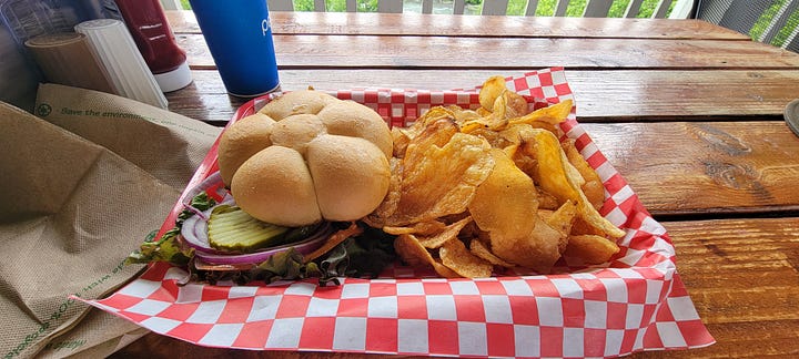
For lunch I ordered the Black and Blue Burger, with Blue Cheese and grilled onions with their house kettle chips. To start, the burger was perfectly cooked and came with all the right amenities. If that was all I had eaten I would have been a happy man. However, I am not a potato chip lover and when I asked if they had French Fries the waitress said they do house made kettle chips (While writing this up I went back and looked at an online menu that shows they do have fries, but I can’t verify the date of that menu). Anyway, I didn’t push it and accepted the kettle chips.
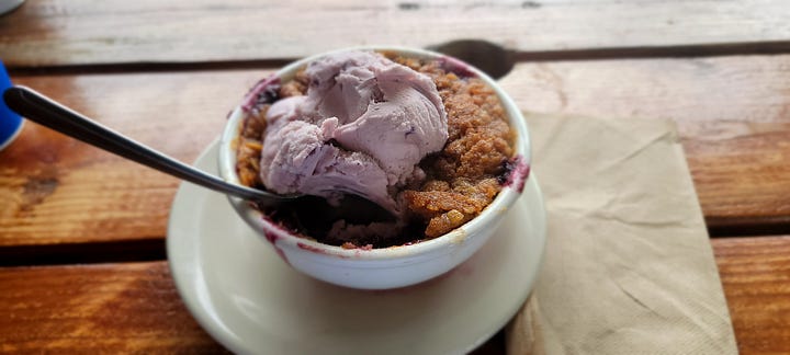
When the food arrived I thoroughly enjoyed the burger, and I ate about half the chips and had to stop as they were too thick and too fried making them very hard to eat. I heard another patron ordering dessert, so I ordered up their house made Huckleberry cobbler with Huckleberry ice cream. It looked photogenic upon arrival but once I dug in the crumble on top was soft and almost cakelike, not the crumbly consistency one would expect from a cobbler. The fruit filling was bland as was the ice cream. I ate 3-4 bites, paid and left.
Judging from what I saw other diners getting, and based on my hamburger alone I’d say this is still a strong contender for a stop when visiting the mountain (And I will definitely stop there again the next time I’m in the area). However, unless you really love potato chips stay away from theirs, and your mileage may vary with the cobbler.
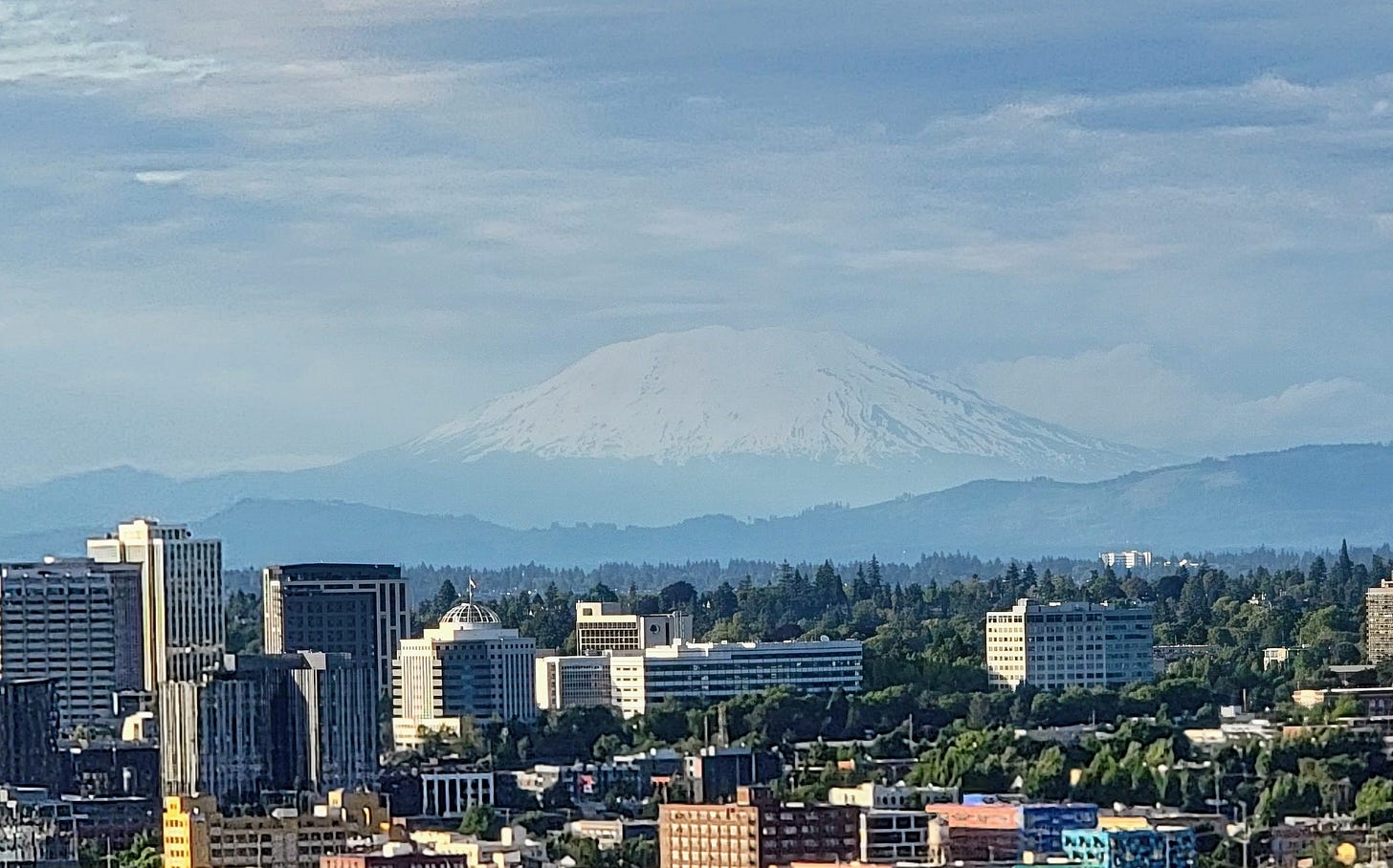
The rest of the afternoon was uneventful as I made my way back to Portland. A couple hours after I got back home I looked out the window and saw a nearly perfectly framed mountain. If only it was that clear when I was actually there.
Oh well, now I have an excuse to head back once the upper trails open up and I can get to the Observatory. All-in-all another great day exploring the northwest.